| Difficulty | 2 stars The trail is easy to follow and while does gain elevation, the route is more of a gentle climb than anything intense. Being so short, this is an easy trail for nearly all levels of hikers. |
| Time to Complete | 3.0 hours |
| Distance | 6.0 miles 6 miles round trip, with an addition to continue climbing for more incredible views. |
| Seasonality | Spring, Summer, Fall |
| Fees/Permits | None |
| Dog Friendly | Yes |
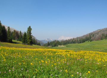
Few trails are as rewarding as Bonneville Pass. Rising though a gorgeous valley, the trail climbs to the top of the pass to the Continental Divide. From the Pass mountains tower in the distance while the flowery meadows and streams adorn the land below. Bonneville Pass is a feast for the senses, from the fresh mountain air to the peaceful, grandiose landscape. Ascend above the pass for deep views of the mountain valleys and towering peaks, not to mention a good look at the trail you’ll use to return home.
What Makes It Great
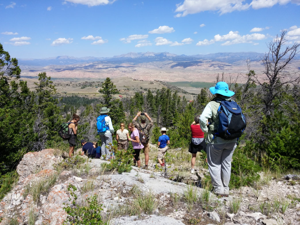
Have you been searching for a hike that wanders through miles of wildflowers? The valley corridor up to Bonneville Pass is less than 30 miles from Dubois, so it’s well worth a visit. Starting with a stream crossing that could be tough in early spring, the trail works its way through forests before eventually crossing a few more streams before reaching the open meadows. In early to mid-summer, the flowers put on a dazzling display. As an out and back, the trail ends at the lake and the pass just beyond. From here there are no formal trails but the open terrain is perfect for exploring—just step lightly and try to stay on rocks and other durable surfaces. For those who are picky about their max elevation, the pass tops out at 9,900’, so they may want to wander up an additional 100’ to reach 10,000’ above sea level. Make sure to keep an eye out for incoming storms in the early afternoon, especially in summer months.
Above the pass itself, there are plenty of hills to scramble. Both the Wind River Range and the Absaroka Range will be in sight on a clear day. In late summer and early autumn, splashes of color will flare up in the flora. The hardiest of tiny flowers will stand in defiance until the first snows come to the land (usually in mid-September).
Who is Going to Love It
This hike is for anyone looking for a true taste of pristine wilderness and alpine bliss in the Shoshone National Forest. It’s not an easy hike but the amount of wildflowers found during the summer bloom is enough to entice any hiker to push a little farther up the hill. The novelty of hiking along the Continental Divide is a bonus. Most of the views along the upper reaches above the pass are well above treeline, perfect for photographers who want to capture the grandeur of this quiet and remote destination. The wildlife here is active, so bring along bear bells / spray or better yet, a couple of friends!
Directions, Parking, & Regulations
Head North on US-26 W/US-287 N for 20 miles from Dubois. Take a right on Brooks Lake Road and follow it for 4 miles. Take a slight right on Forest Service Road 516 and your trailhead will be on the right in 1.7 miles.
Save